

|
|
August 4th 2012 was the second of two decent thunderstorm days across UK and Ireland which I had my eye on for chasing. A fairly deep low pressure system over the Atlantic Ocean to the SW of Ireland was slowly moving NE over the southern half of the country and with its associated fronts and troughs there was potential for widespread thunderstorms in the post frontal air mass and in the vicinity of the low with numerous sources of lift such as troughs, convergence zones and strong solar heating so it looked like a good day for storms. The previous day ended up being quite spectacular with massive thunderstorms across the S and W Republic while N. Ireland stayed almost dry the entire time which was very frustrating as I was ready to chase at a moments notice. The most powerful cell of the day formed in isolation away from the larger mass of storms and moved N across the border into the SW side of N. Ireland however it was too far away for me to get to in time so I had to watch it on radar and via satellite images with envy, it looked a beast of a storm too with long duration red echoes and spitting out a high rate of c-g lightning. The cell didn't go unnoticed however as my storm chasing friend Paul Martin managed to catch it in the act as it passed over Omagh rumbling away before finally moving into W Ireland and S Donegal, I'm glad Paul captured it as it was the only N. Ireland storm of the day.
The next day looked much more favourable for N. Ireland so I had high hopes of making up for yesterday's bust. This was a classic unstable post frontal air mass with 800 CAPE and LIs of -2 however upon closer inspection using the higher resolution models it became apparent that surface based CAPE was rather low over N. Ireland however mid level CAPE or mixed layer CAPE (MLCAPE) was high so I was expecting high based storms, this wasn't good for tornadoes and funnels however it boded well for electrical activity for any updraughts which did form wouldn't have far to go to hit the freezing air aloft, produce ice crystals, and hence lightning. My girlfriend Roisin and I went storm chasing early in the day however it soon dawned on us that storms where unlikely here because of the presence of a strong cap. A cap or capping inversion is a layer of stable warm air above the boundary layer, for storms you need cold air aloft so this warm layer would kill any chance of storms because the cap literally acted as a lid on a boiling saucepan so any updraughts would never reach the great heights required. This cap was evident all day long, we observed plenty of towers trying their best to do something interesting however their fight was handicapped from the first round so they had no chance unless something changed. This capping inversion was easy to observe because all the towers would reach a certain height then they would flatten out and decay as if they hit an invisible ceiling so things didn't bode well at all.
I tried to find some hope in the situation by turning my attention again to the charts. Storms broke out down south again however the most spectacular action was over N. England, Wales, and the far SW Scotland where many intense thunderstorms broke out all afternoon producing high rates of lightning and spectacular funnel clouds but nothing over Ulster. The animated satellite images showed the centre of the low over SE Ireland with one of it's spiral arms/troughs (producing storms) located over Wales/Scotland and from studying the counter clockwise rotation of the low I figured there was a chance of getting a few cells from that spiral arm later when the low's rotation brought part of that region over the ocean and into NE N. Ireland, however it was an extremely slow process and by the time it hit land and sparked convection then it may be too late as the bulk of the CAPE was here at 15.00 and by 18.00 the unstable air would sink over S N. Ireland so it was all on a knife edge.
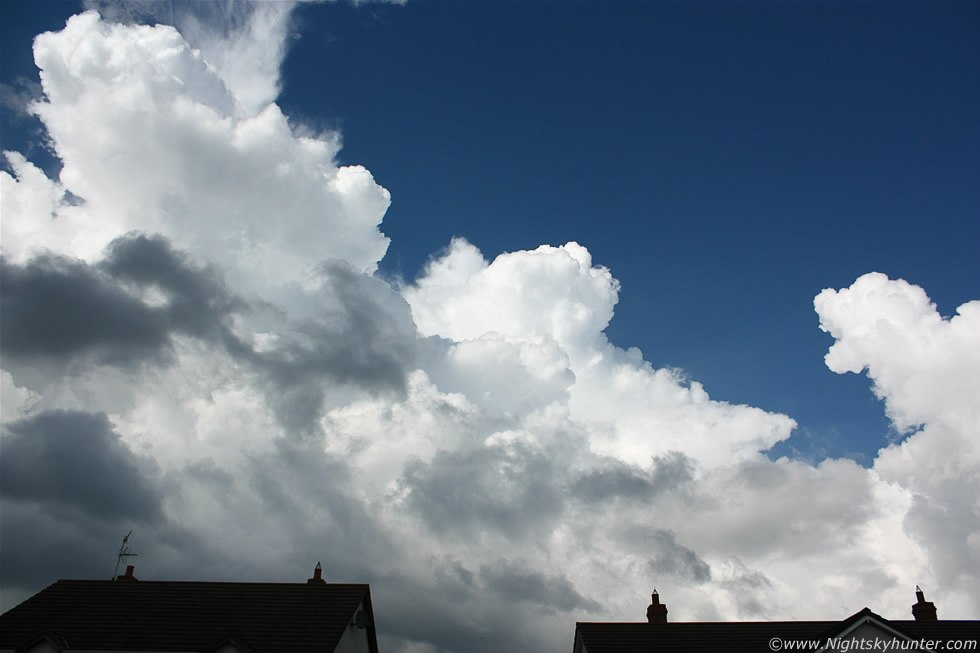 |
It was a glorious hot afternoon with blue skies and scattered cumulus and by 16.00 I considered the day a bust yet again so we returned home. After a nice lunch I checked the internet again and got a shock when the latest radar update showed precip breaking out and intensifying to the E of my location, I looked out my bedroom window and realised everything had changed in an instant, this was the view from my back garden looking N over the neighbour's rooftops, I knew immediately that the cap had broke!. A cap can break if it erodes by the intrusion of cold air aloft or if convection gets strong enough to punch through the warm layer and it was both that went to work here, in fact, a cap can be a good thing if its the rite kind, a little like Goldilock's porridge, which can hold back real convection all day until the atmosphere becomes a loaded gun and suddenly erupts into life resulting in explosive thunderstorm development and that's exactly what happened between 17.00 and 18.00 this afternoon. I normally like to shoot storm clouds out in the open but I was caught off guard by this rapid storm development that I had no choice but to shoot from home, check out those solid towers and Cb Calvus thunderheads which looked stunning against the crisp blue sky.
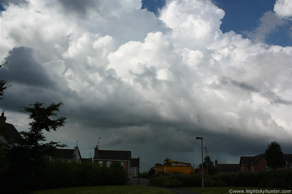 |
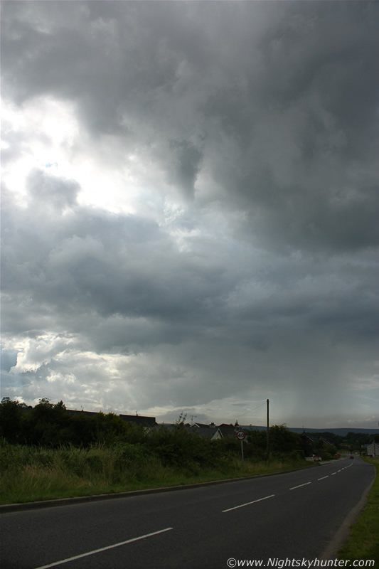
My view of the base was obstructed by the houses and my car was away so I decided to go on a foot chase. I grabbed my rucksack with camera, 100-400mm lens, and video camera then flicked over the fence and ran through the neighbourhood for a better view, I stopped here to take a quick shot where I had a clearance, this was a young and beautiful cell tapping into all that MLCAPE and forced upwards by hours of intense ground heating. The houses provided a good sense of scale, the cell itself was a couple of miles away and quite massive, you need to combine these first two images one on top of the other to get a complete mental picture of the scene.
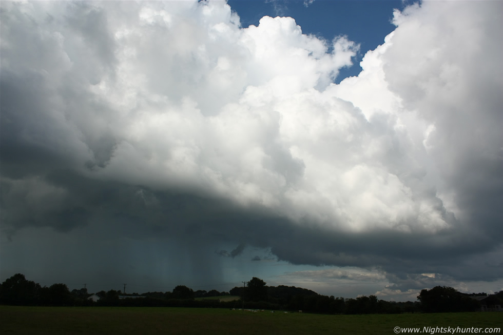 |
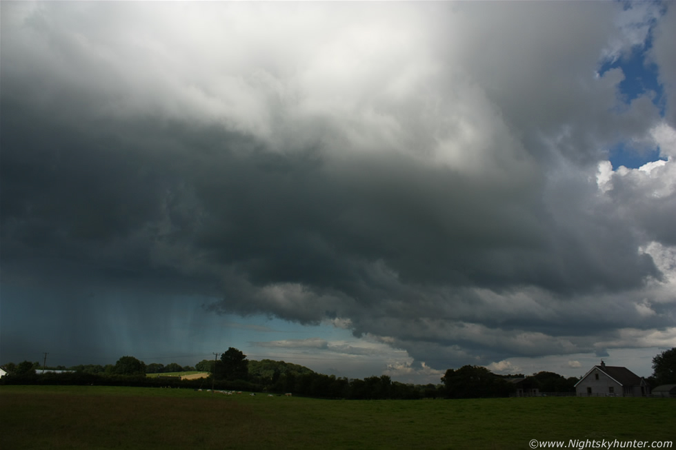
I got out of the neighbourhood and crossed the road to a local field where I had a superb view of the base. The cell was too large to fit in the 18mm frame so here's the lower and mid level portions of the central updraught and flanking region with well defined precip core dropping a heavy shower over the countryside to the N of town, this one had formed on the flow which had come in from the NE exactly as I had predicted earlier, moving R to L in the frame and towards me.
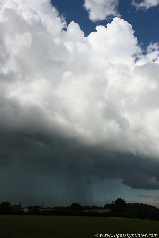 |
This portrait version really conveys the vertical height very well. There was a wonderful blue tone to the sky which could be seen filtering through the precip core from the clearance behind making for a really pure and photogenic convective scene.
 |
The gust front was disorganized but it was still very dramatic looking with strange structure, then the sun broke out behind the cell bathing the fields in the distance in fantastic light, meanwhile where I was standing the towering thunderheads where far above me and soon would be lost behind other clouds, I could see new towers over the Sperrins and to my S however the sky was getting messy here so I went back home, I didn't get any bolts from this cell but it was good quality photogenic convection so I will take it and the fact that it was the first cell to form when the cap broke that day made it all the more special.
 |
Back at home the radar confirmed things were kicking off and another visual check of the sky showed the cell I had been watching had got alot more interesting and I suspected funnel clouds were possible so Roisin and I went out on a local chase, this time we had the car. We drove a couple of hundred metres then pulled off the road onto the grass verge for a look at the sky. There where dark low bases far away to the NE behind our cell than I glanced to the zenith under the base and spotted a funnel cloud, I couldn't believe it so I snapped a few rapid fire shots before it vanished. The funnel can be seen as a dark tube visible from the upper R corner of the image and bending downward with its snout at image centre, how long had this been visible?, I had no idea but it was now already near the end of its life.
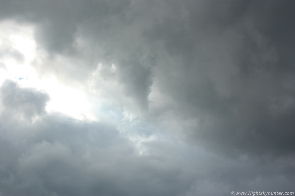 |
A 55mm shot showing the snout. This was a most unusual funnel because it formed from a high based (elevated) cell which is something I had never observed before, just a pity it was blocked by cloud and in poor light however it was still another funnel in the bag making this my third catch this year. This oddity is just another example of how strange this storm season has been and how anything is possible, especially when you least expect it. Soon after this another big cell exploded to life which we spotted from Glenshane which produced torrential rain over my home and proceeded to produced a battery of c-gs down the entire W side of Lough Neagh with more storms over S N. Ireland and Omagh before the instability slipped away bringing another strange storm day to an end. Roisin and I ended the chase parked on a roadside watching the top of a beautiful white elevated cb in the direction of Lough Neagh (the c-g producer) which looked fantastic in the high contrast low evening sun along the E skyline while opposite to our W where two colourful sundogs biding us farewell until next time. What a strange day and a testament to the emotional roller coaster of emotions in storm chasing and to the amazing unpredictability of the weather in N. Ireland. Many thanks for reading.
Martin McKenna